MATLAB based Joint inversion algorithm to invert ERT and Gravity data
Motive-Interpretation of single geophysical data set is not sufficient to get the complete subsurface information. The main logic behind joint inversion where two are more different types of geophysical data sets were combined in single inversion framework with the goal of enhancing the subsurface image quality. In that scenario, drawback of one geophysical method can be minimized by application of other geophysical method.
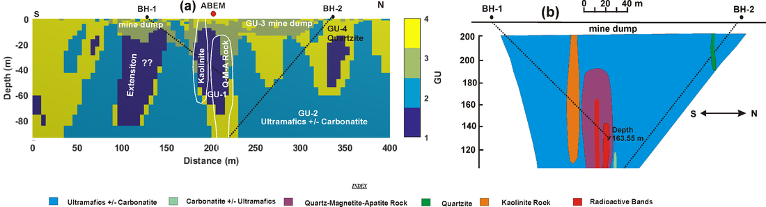
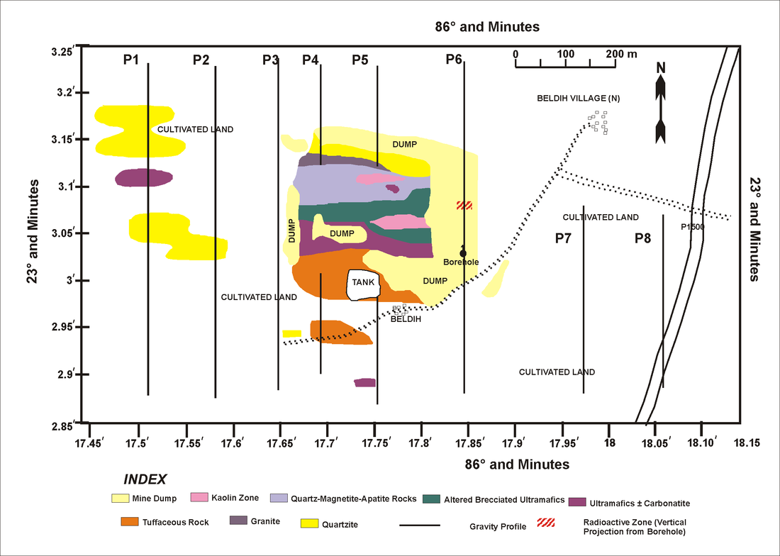
During my Ph. D., I have made a successful attempt to develop MALAB based joint inversion approach of DC resistivity and gravity data in deterministic inversion framework. Geologic knowledge and petrophysical relationship were brought into common inversion framework along with DC resistivity and gravity data. Further, Joint clustering inversion approach was utilized to identify the extension of uranium bearing target rock around the Beldih open cast mine.
Comparision between two subsurface models can be seen in the following image. Figure(a) is the Geophysical lithotype obtained from joint inversion and Figure(b) is the lithotype obtained from Borehole ( BH-1 and BH-2) information along with drilling direction with black dotted line of Mandal et al. (2015).
This work is in under review.
Fuzzy Constrained Inversion of ERT data
Highlights
- This works presents the use of fuzzy c means clustering procedure to improve the two-dimensional (2D) resistivity imaging.
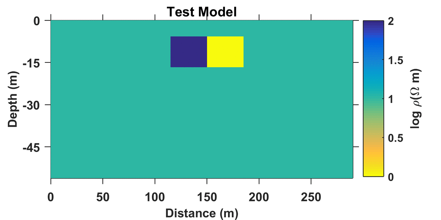
- MATLAB code for Lp-norm inversion of the 2D direct current (DC) resistivity data.
- Two additional input parameters are added as the number of cluster and the cluster center values directly into inversion framwork.
- Inversion results from the presented fuzzy constrained inversion (FCI) were compared with the resistivity image achieved using conventional L1 and L2 norm minimization techniques.
- The presented FCI shows improvement with respect to conventional inversion approach.
|
This work was a part of my PhD work and I will be happy to discuss about it. If you are interested in my work or in algorithm code, feel free to email me.
For more detail please refer our article- Singh A., Sharma S.P., Akca I.,Baranwal V.C., 2017, Fuzzy Constrained Lp-norm Inversion of Direct Current Resistivity Data, Geophysics, 83 (1), 1-14 |
|
Fuzzy Cooperative Resistivity Tomography to invert Magnetotelluric (MT) data
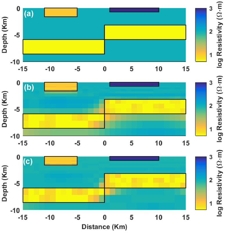
Efficacy of the developed algorithm can be seen in the image given below. Inversion results are shown on the TE mode of magnetotelluric data. Figure (a) is the true resistivity model. Figure (b) is 2D resistivity image obtained from unconstrained inversion approach and Figure (c) is inverted resistivity section using the presented FCRT. Both inverted resistivity models replicate the observed apparent resistivity and phase data to its noise level. The black boxes in models (a, b, and c) show the boundaries of the true resistivity distribution.
Feel free to email me if you are interested in my work.
Feel free to email me if you are interested in my work.
Fast imaging technique for the interpretation of VLF-EM data
Highlights
A new subsurface imaging technique for the interpretation of VLF electromagnetic data over variable topography. Subsurface structure modeled in terms of normalized current density.
Imaging results from the presented formulation were compared with other imaging techniques in terms of apparent current density and resistivity distribution using a standard numerical forward modelling and inversion technique. Efficacy of the developed approach was demonstrated for the interpretation of synthetic and field very low-frequency data. The presented imaging technique shows improvement with respect to the filtering approaches in depicting subsurface conductors as shown in the image given below. Further, results obtained using the presented approach are closer to the results of rigorous resistivity inversion.
More detail can be obtained from onlinelibrary.wiley.com/doi/10.1111/1365-2478.12323/full
Unstructured Grid based zonal cooperative inversion algorithm for Gravity and Magnetic data
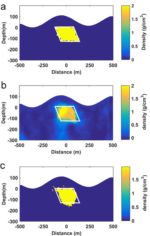
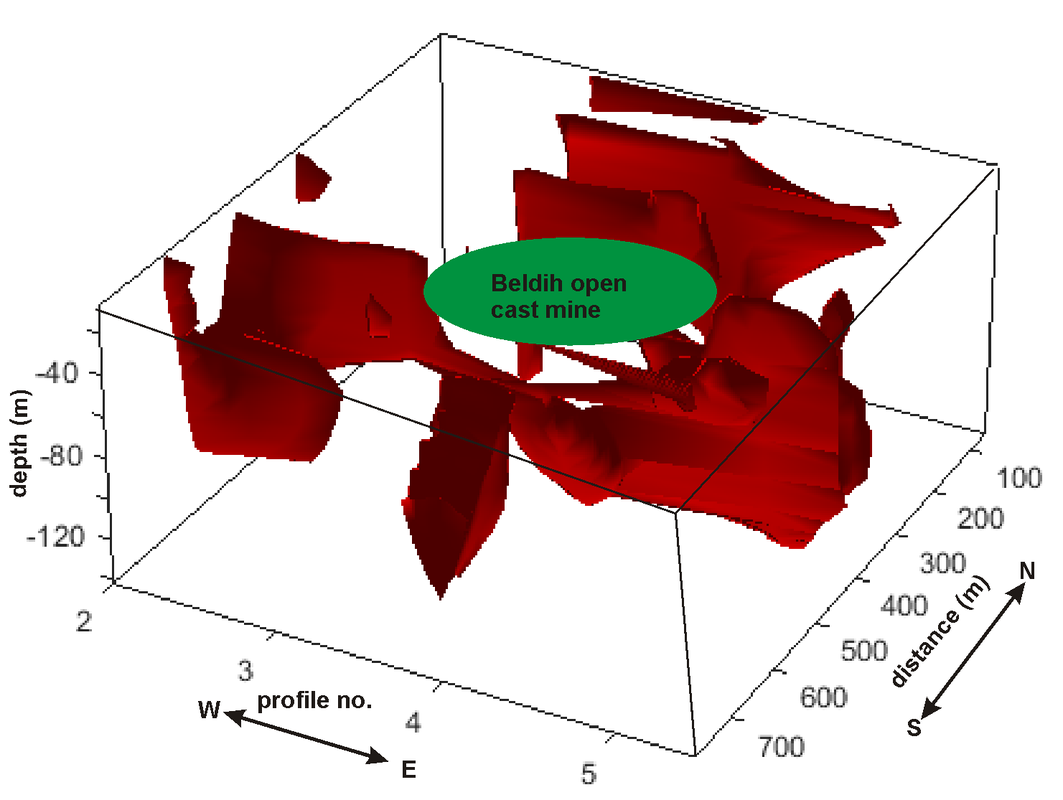
Here, We present the results of modified zonal cooperative inversion of gravity data on unstructured grids using guided fuzzy c means clustering approach. To improve the efficacy of the zonal cooperative inversion prior parametric information was consolidated into a deterministic inversion framework. This prior parametric information can be extracted from lithology observations, well logs, and complementary information from other geophysical methods. The presented approach shows improvement to identify the boundary between two lithologic units. The field example data was used to map the extension of kaolinite and quartz–magnetite–apatite rocks (target rock of uranium mineralization) around Beldih open cast mine.
Details of the algorithms can be found here
Details of the algorithms can be found here
|
|
